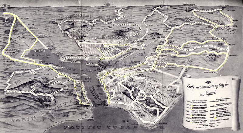
San Francisco, via Gray Line

San Francisco still has Gray Line offering bus tours of their beautiful city, all these years later. The map above is from 1953, from a pamphlet called "Really See San Francisco." I'm just including the map here, but the rest may follow someday. Nearly 60 years ago, here's what the attractions via a bus tour were:
- Deluxe 30-mile drive around San Francisco
- Chinatown After Dark
- La-Honda, Ocean shore, and Stanford University
- Oakland, Berkeley, and U of Calif.
- Santa Rosa, Petrified forest and geysers
- Mt Tamalpais, Muir Woods, and Marin County
- Del Monte, Santa Cruz
- Stanford University and peninsula
- Muir Woods, big trees, and Marin County
- Yosemite Valley and Del Monte
- Oakland, Berkeley, Muir Woods, big trees
- San Francisco, Oakland, Bay Bridge, Lake Merritt
- Golden Gate Bridge
As for the map itself: I'm a fan of purposeful maps, ones that don't spare the information about what it feels relevant, but ignores the irrelevant whenever possible. This isometric view includes landmarks and gives a nice sensation of distance, which then also lets riders know how much time will be spent looking out the window at non-landmarks.
Labels: 1950s, 1953, california history, gray line, maps, san francisco


