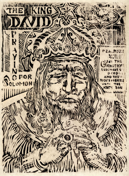
The King David Praying For Solomon, a woodcut by Shirley Swenson. Note the reversed letters on the right (would be the left side of the printblock). The print is not dated nor numbered, but it is quite clearly an original hand-printed piece of art. The size of the woodcut was huge — 13″ x 18″, and carries enormous detail. It was poorly mounted in a cheap frame, and the materials used seem to date to the 70s or 80s. According to a note on the back, Shirley Swenson was the daughter of Cora Swenson of Libby, Montana. No other information is available. We purchased it for $15 at the Moorhead Salvation Army thrift shop.
Tag: 1980s
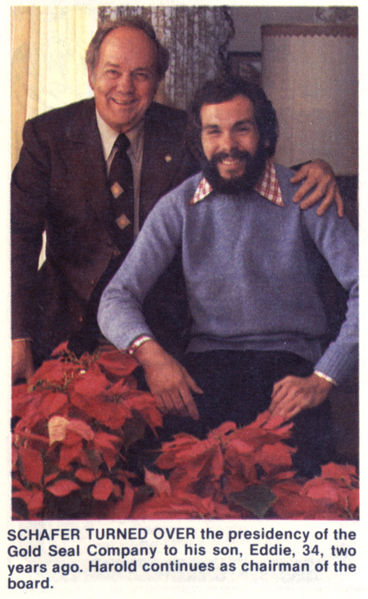
Little Eddie Schafer and His Dad
“Eddie” over there on the right, has a tough road ahead of him — despite his shaggy appearance and obese lapels, he’s got big shoes to fill. His dad, a prominent North Dakota businessman, had appointed Eddie to be his successor in taking over the family business. How do you think Eddie did? Would a guy named “Eddie” ever do well in any career other than car sales or running a pawn shop?
As president of Gold Seal, Eddie was in charge of the Mr. Bubble fortune, but it didn’t take long to drop the childish suffix. Harold Schafer’s son, now just “Ed Schafer”, went on to be North Dakota’s governor for most of the nineties — only 11 years after this photo was taken. He remained politically active after his term, and just recently George W Bush appointed Schafer to the position of Secretary of Agriculture. Here, have a look at Eddie today: he’s come a long way from a goofy smile and gingham dress-shirts.
The Red River Mall
I remember the “mall” from my youth, but it barely registers that it ever actually had a name. The Red River Mall was a misguided attempt to revitalize Fargo’s downtown, which (whether directly or indirectly) led to downtown Fargo’s near-collapse in the late 80s and early 90s, and forcing the renewal plans that threaten to cause another Red River Mall-like slump.
In the 1960s and early 1970s, the nationwide Urban Renewal movement hit Fargo and Moorhead: Moorhead got an actual indoor mall to replace the dozens of retail stores and apartments downtown. Fargo got tall buildings, open spaces, and the Red River Mall. The Mall wasn’t a direct knee-jerk reaction to the creation of the West Acres Mall, but it was hoped to counter the movement of stores away from the downtown area. Fargo’s retail center stretched from around 8th Avenue north to 5th Avenue South, and extended east to around 2nd Street and west to 10th Street. Modern Fargoans may be wrinkling their brows at this range, wondering how downtown Fargo was ever that big: today, Downtown starts at 6th Avenue and stops at Main, and barely extends a block off Broadway. The rest of those buildings? They were replaced by modern office buildings, they burned and were paved over instead of rebuilding, they were sacrificed in favor of flood protection, they were demolished to create parking lots, and they got absorbed by their neighbors.
So, by the early 1970s, Downtown Fargo was in a poor position: it had a number of department stores, but its retail influence was shrinking. Small malls were popping up at the edges of town where new houses were being built. And then, West Acres gave the department stores the final boost to move out.
That left large, empty buildings, struggling locally-owned stores, and a loss of shoppers. The city, in its infinite wisdom, saw the possibility of turning Downtown Fargo into something akin to Nicollet Mall in Minneapolis.
Here’s how the plan went: Broadway, formerly two lanes with parking along all sides, would be turned into a winding, parking-less, snake-like street emulating the curvy nature of the Red River. Keeping to the curvy road, large cement pylons would mark the borders. To appeal to pedestrians, at their appropriate places along the “river”, marble place-markers represented the border cities. To keep rain and snow off pedestrians, overhanging roofs would line the street close to the buildings. Trees remained, or were planted for aesthetic reasons, with nice sitting places scattered throughout.
As you might guess, with the loss of large stores shoppers weren’t going downtown much, and now that Broadway was difficult to navigate they were less likely to do so. Sidewalk ceilings helped some, but weren’t enough encouragement. The Red River Mall eliminated a lot of downtown parking, which caused more buildings to disappear from along the streets, further reducing retail spaces in exchange for mostly-empty parking lots.
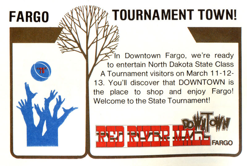
In 1976, optimism was still high: the Red River Mall was still an attraction. It was only a year or two after West Acres’ debut, so there was less evidence of replacement, as opposed to an expansion of retail opportunities. Downtown stores hoped that regional events like the basketball tournament would draw shoppers to our repackaged ‘shopping mall’ and stop by. Eventually, it became clear that the Red River Mall was nothing more than shiny wrapping paper on an unwanted, regifted chotchke: even its name slowly dropped out of popular use, and Broadway’s retail influence all but stopped.
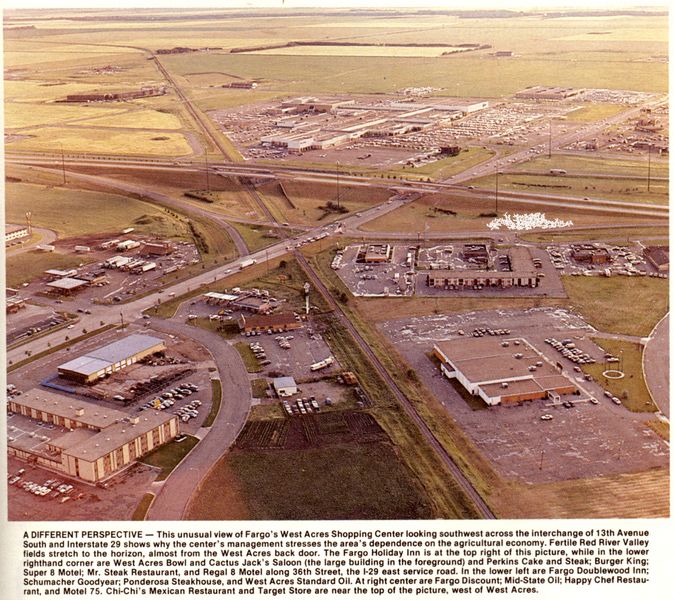
Ever-Expanding Fargo
If you had no idea that Fargo has grown in leaps and bounds, let’s look back 25 years. In 1982, this photo was taken for the Binford Guide to commemorate the 10th anniversary of West Acres Mall. The mall is seen in the upper-center area of the photo — and beyond that are miles and miles of farmland. 45th Street, barely visible at the top edge (it was a dirt road then) is about a mile from I-29: today (see a Google Map), the green, lush farmland you see is almost entirely paved and filled with a zoo, the YMCA, the largest Scheels store in the world, a 6-story office building (in which the Infomercantile webserver lives), and numerous other offices, strip malls, big-box retailers, and apartment buildings. The growth of the Fargo area is dumbfounding sometimes; when they talk about rural areas shrinking in population, it’s because they’re coming to the bigger cities. One thing I find most interesting, from both the photo and the aerial map, is the identification of what’s new versus what’s old based on the railroad line that used to run through this part of town. Buildings built on the diagonal were there before the tracks were removed; buildings on the north-south lines are new.
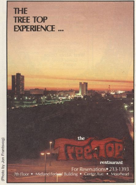
Fargo’s North Dakota Skyline
We’ve seen the North Dakota scenery from West Fargo in the 1930s, which is a little unfair to the area. In 1983, the Tree Top restaurant — once at the top of the tallest building in Moorhead — put this photo in their advertisement. At the far left is the low-income highrise, thanks to Urban Renewal; a little to the right of it is the Professional Building, where my childhood doctor worked; a little right of center is now the Bank Of The West building (formerly a half dozen other bank names), and to the right of that is the microwave tower on top of the Burlington Northern offices. We’re looking straight west from the MF Building — but that’s not really downtown out that way. Downtown Fargo is off to the right of this photo, and would have been dominated by the Fargo Forum’s neon sign, the Black Building, and the First National Bank building. It could be partly that this was the best angle, with the setting sun; it could also be that those were the tallest, most-modern buildings in Fargo at the time, while the next-tallest buildings are examples of Art Deco and Federalist styles of the early 20th century, and who wants to see that? But if they were looking for tall buildings — why not take a picture of the Radisson? Sorry, that was still two years away.
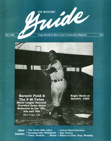
The Last Binford Guide
Howard Binford was a journalism icon in the Fargo-Moorhead area during the 60s and 70s, training the media personalities of the future and publishing his own magazine. Late in life, Binford starting publishing his Howard Binford’s Guide in 1968, interviewing a series of locals who were quite obviously Binford’s friends, church acquaintances, advertisers, and co-chairs on local boards. Still, he was a bright and entertaining editorialist, and the magazine was actually useful to non-locals on holiday and residents alike.
Looking forward, Binford began to pass control to his assistants in 1984, sold the magazine to a local publisher in 1986, but his health got the better of him at the end of 1988 and he passed away. Without Binford, the Guide ended publication with the May 1989 issue. The Guide was clearly valuable to the community: most of the magazines I’ve collected were aquired in large lots — people saved years and years of the guide in their basement. I’ve got almost the entire 1980s uploaded, a good part of the 70s, but those 1/8th-size pre-1975 Guides are tough to find.
Rusk Auto-House Found
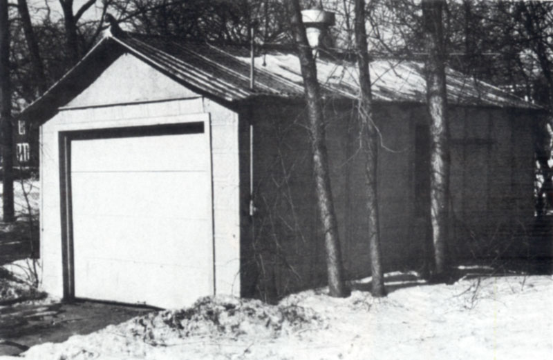
When I first learned about the Rusk Auto-House, I discovered that one was placed on the National Register of Historic Places, Building #87002634 — but the address didn’t make sense. I walked around that block, and found nothing but parking lot. I assumed it was torn down quite some time ago, but in going through my Binford Guide archive I found a photo of that very Rusk. Located on a house’s driveway exiting on to 7th avenue, a half block west of Broadway and facing St. Mary’s Cathedral, sat this pressed-steel garage. That was in 1988; the garage must have disappeared not long after, as I don’t ever remember anything on that corner except parking lot.