Click for full image
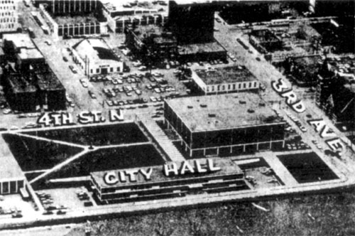
In April, 1969, the Red River of the North overflowed its banks, reaching 37.3 feet on the 15th, and expected to crest at 38 feet a few days later. This aerial photo appeared on the front page of the Fargo Forum on the 15th, showing the dike’s position in relation to saving city hall, the Civic Center, and the year-old library. Today, the dike runs down 2nd street, atop the river bank, but in 1969, they let the swollen river cover the big parking lot, and ran the dike along 3rd street, just outside City Hall’s front doors; the Town House hotel, at the far right in the big picture, looks on the verge of flooding, but safe enough.